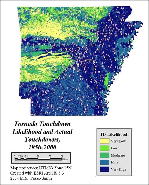
The Encyclopedia of Arkansas online provides a map illustrating the likelihood of a tornado touching down in different parts of Arkansas. Northeast Arkansas is in the top right of the state, located in the darkest blue indicating a “Very High” likelihood of tornado touchdown.
Below are the most significant wind events in Northeast Arkansas.
Tornadoes
- 2010, April 30 — Tornado in Clay County
- 2006, April 2 — F3 tornado moved through Randolph, Lawrence, and Greene counties, resulting in 52 injuries, 5 injuries of critical condition, 1 death
Other Damaging Wind Events
- 2018, June 2 — Lawrence and Randolph counties experienced a bow echo wind event of up to 80 MPH
- 2017, May 27 — Clay, Lawrence, and Randolph counties experienced a derecho with winds up to 70 MPH, causing damage to trees and outbuildings
Tornado Alley Is Moving East
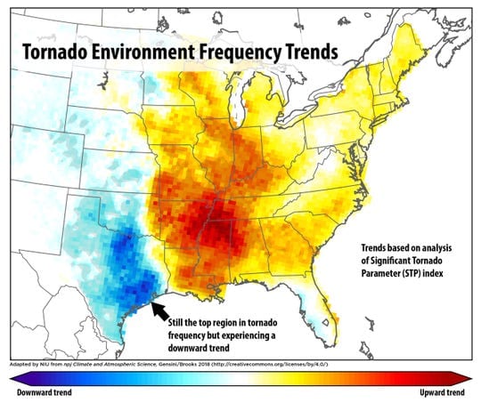 According to a 2018 USA Today article, data from 1979 to 2017 indicate Tornado Alley, originally located in the central and southern Plaines, Oklahoma, and Texas, is moving further east. State impacted include Arkansas and Missouri.
The map to the left illustrates in red the areas which are becoming more impacted by tornadoes. Northeast Arkansas is in some of the darkest red.